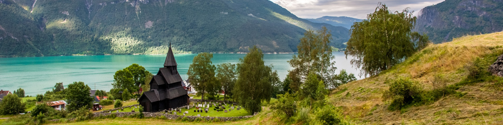
The Upper Middle Rhine Valley covers a 65 km stretch of the River Rhine in Germany. The Upper Middle Rhine Valley is located between the cities of Bingen-Rüdesheim and Koblenz. The Rhine was the northern border of the Roman Empire. Bingen was once the starting point for the Via Ausonia, a Roman military road that linked the city with Roman Trier. Bingen-Rüdesheim is the southernmost point of the World Heritage Site; here the river enters the Rhine Gorge, a narrow rock-walled gorge. The 'Binger Loch' was a shoal in the River Rhine; long ago it was an obstacle for ships. For a long time horses were required to pull ships across this dangerous point. The most dangerous rocks were blasted in the 17th century. The Loreley (also Lorelei) is a 132-metre-high rock on the eastern bank of the Rhine near St. Goarshausen. The Loreley marks the narrowest and deepest point of the Rhine between Switzerland and the North Sea. The Loreley is also known for the 'Legend of the Loreley'. Koblenz is the northernmost point of the World Heritage Site. The Upper Middle Rhine Valley is a landscape of cultural, historical and artistic importance. The Upper Middle Rhine Valley owes its special appearance both to the natural shape of the river and to human hands. For two millennia the Rhine has been one of the most important transport routes between central and northern Europe. The Upper Middle Rhine Valley, with its castles and ruined castles on prominent hilltops, historic towns and vineyards, has exercised a powerful influence on artists, composers and writers. Victor Hugo, Heinrich Heine and Goethe not only visited the Rhine Valley but also wrote about it. Two other World Heritage Sites near this stretch of the Rhine are: the Abbey of Lorsch and Speyer Cathedral. The Upper Middle Rhine Valley became a UNESCO World Heritage Site in 2002.
www.werelderfgoedfotos.nl © Copyright World Heritage Photos

The picturesque Pfalzgrafenstein Castle lies in the Upper Middle Rhine Valley close to Kaub; the former stronghold was built on the small island of Falkenau in the Rhine. Pfalzgrafenstein is the most famous of the many toll castles along the Rhine. The Upper Middle Rhine Valley has had a profound influence on composers, painters, poets and writers. This landscape is associated with history and numerous legends; the most famous is undoubtedly the Legend of the Loreley.

The picturesque Pfalzgrafenstein Castle lies in the Upper Middle Rhine Valley close to Kaub; the former stronghold was built on the small island of Falkenau in the Rhine. Pfalzgrafenstein is the most famous of the many toll castles along the Rhine. The Upper Middle Rhine Valley has had a profound influence on composers, painters, poets and writers. This landscape is associated with history and numerous legends; the most famous is undoubtedly the Legend of the Loreley.

The Upper Middle Rhine Valley near Bingen; the town of Rüdesheim is situated on the opposite bank of the Rhine. Bingen and Rüdesheim mark the southernmost point of the UNESCO World Heritage Upper Middle Rhine Valley, while Koblenz marks the northernmost. The 65 km stretch of the Rhine presents breathtaking views of small villages, castles and vineyards; the landscape owes its magnificent setting both to the natural shape of the Rhine and human intervention.

Upper Middle Rhine Valley: A ferry crossing the Rhine at Lorch. The Upper Middle Rhine Valley is also known as the Rhine Gorge; this is a landscape of immense cultural and historical value. The Rhine Gorge is remarkably deep; it is famous for its natural beauty, its villages, castles and ruins surrounded by vineyards. The Upper Middle Rhine Valley is also known as the Romantic Rhine. The Rhine Gorge inspired great composers such as Wagner and writers such as Goethe.

Upper Middle Rhine Valley: The Free State Bottleneck (Freistaat Flaschenhals) near Kaub. After WWI, Germany was divided into occupation zones. Due to a wrong calculation, the French and American occupation zones did not meet entirely, leaving a narrow strip of land in the shape of a bottleneck. The area around Lorch and Kaub remained outside the occupation zones, called the Free State Bottleneck. It existed from 1919 until 1923, with Lorch am Rhein as its capital city.

The Upper Middle Rhine Valley has an ideal climate for producing wine and is one of the most important wine regions in Germany. The Romans introduced viticulture to the Moselle Region, from where it spread to the Rhine Valley during the Middle Ages. The iconic terraced vineyards were built on the steep slopes of the Rhine Valley. They are situated around charming medieval wine-growing villages such as Boppard, Bacharach and Kaub.

Upper Middle Rhine Valley: A barge (rijnaak) on the Rhine near Lorch am Rhein, once the capital of the former Free State Bottleneck. For over two millennia, the Rhine has been one of the most important transport routes between Central and Northern Europe. The vessels most frequently operating on the Rhine are the long and narrow Rhine barges. The Upper Middle Rhine Valley, stretching from Bingen and Rüdesheim to Koblenz, was declared a UNESCO World Heritage Site.

Upper Middle Rhine Valley: A campsite on the banks of the river Rhine. The Upper Middle Rhine Valley has been inhabited since the Iron Age; human interventions have shaped the landscape in many ways for over thousands of years. In Germany, the Rhine was the northernmost border of the Roman Empire. Many cities along the Rhine were founded by the Romans who already used the river as a waterway. Now, the Upper Middle Rhine Valley is a major tourist destination.

Upper Middle Rhine Valley: Pfalzgrafenstein Castle on Falkenau Island in the Rhine near Kaub. It was built by Ludwig of Bavaria in 1327 and served as a strategic toll castle for Rhine barges until 1866. At Kaub, on New Year's Eve 1813–1814, the Prussian Field Marshal von Blücher succeeded in crossing the Rhine with his army, at that time a major achievement. This was a key moment in the final defeat of Napoleon Bonaparte. There is a Blücher Museum in Kaub.

Upper Middle Rhine Valley: The Loreley is a 132-metre-high rock on the east bank of the Rhine. The Loreley (also Lorelei) marks the narrowest and deepest point of the Rhine. The strong river current caused many boat accidents. The Loreley is also the name of the siren. The legend has it: the siren who sat on the Loreley, combing her long golden hair, enchanted passing sailors by singing. When they looked up to the rock, distracted by her beauty, their boat would crash against the rock and sink.

Upper Middle Rhine Valley: The Loreley statue at Sankt Goarshausen. 'Die Lorelei' is a poem by the German poet Heinrich Heine; his work about the singing siren on the Loreley rock became world-famous. It was set to music for the first time in 1838. The poem 'Die Lorelei':
Ich weiss nicht was soll es bedeuten, Dass ich so traurig bin.
Ein Märchen aus uralten Zeiten, Das kommt mir nicht aus dem Sinn..........
(I wish I knew the meaning, A sadness has fallen on me. The ghost of an ancient legend.
That will not let me be............)
