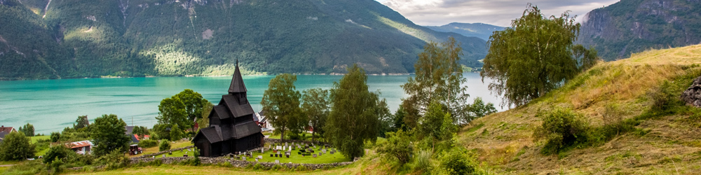
Agricultural Landscape of Southern Öland: The Island of Öland is located in the Baltic Sea, just off the east coast of Sweden. From Kalmar on mainland Sweden, Öland is reachable by a road bridge, the more than 6 km long Ölandsbron. People have lived here for more than 5000 years and left their mark on the unique landscape of Southern Öland. There are traces from different ages, from prehistoric times until the present day, amongst them Iron Age settlements and ancient grave fields. Gråborg Fortress is the largest Iron Age ring fortress of Sweden. Gråborg Fortress and 19 other similar constructions on Öland were built in the centuries during which the Roman Empire was collapsing. Seby is one of the largest ancient burial grounds of Öland including 285 graves, the burial ground was used until the Viking Age. The southern part of Öland is dominated by the Stora Alvaret, the Great Alvar. A great assortment of vegetation is found on the limestone plateau of Stora Alvaret. The Stora Alvaret is a vast steppe area with rugged vegetation, wild orchids and the rare Öland rock rose, which only occurs on Öland. The first systematic study of the Stora Alvaret was undertaken by the renowned Swedish botanist and physician Carl Linnaeus, he observed the variety of unusual wild flowers that were able to survive in the sparse soil that covers the limestone plateau. In the 19th century, Öland had about 2000 windmills, some 400 have survived today. Nowadays, the wooden windmills are a symbol of the island of Öland. The Agricultural Landscape of Southern Öland is located about 90 km northeast of the Naval Port of Karlskrona, also a UNESCO World Heritage Site. The Agricultural Landscape of Southern Öland was declared a UNESCO World Heritage in 2000.
www.werelderfgoedfotos.nl © Copyright World Heritage Photos

Agricultural Landscape of Southern Öland: In the 19th century, Öland had almost 2000 wooden windmills. Every farmer had a mill of his own. The mills were used for grinding corn. There are still 400 windmills left on Öland. The windmills have become the symbol of the island of Öland. On Öland, there are traces from different ages, from prehistoric times until the present day. The agricultural landscape of Southern Öland was declared a UNESCO World Heritage in 2000.
Agricultural Landscape of Southern Öland: Möckelmossen is a marshy lake and wetland area at the Stora Alvaret, the Great Alvar. Möckelmossen is known for its rich bird life. The marshy lake and wetland areas of Möckelmossen are popular tanking station for migrating birds. The water area varies throughout the different seasons. During the summer, Möckelmossen partially dries up. Öland has the most hours of sunshine in Sweden.
Agricultural Landscape of Southern Öland: Stora Alvaret, the Great Alvar, is a limestone barren plain. A great assortment of vegetation is found on the Great Alvar, including orchids. The first systematic study of Stora Alvaret was undertaken by Carl Linnaeus who observed the variety of unusual wild flowers that were able to survive in the sparse soil that covers the limestone plain, there is a rare species of orchid that only grows on Öland.
Agricultural Landscape of Southern Öland: Vickleby is a village on Southern Öland. The village has just over 300 inhabitants. The small village consists of a narrow street less than a kilometre long, lined with the typical Swedish coloured wooden houses. The stone church of Vickleby was built in 12th century. In the 1930s and 1940s, Vickleby became a popular residence for artists. The Agricultural Landscape of Southern Öland is a UNESCO World Heritage.
Agricultural Landscape of Southern Öland: A wooden house in the small village of Vickleby. In summer, the gardens of the picturesque village are full of blooming flowers. Vickleby is located nearby the Ölandsbron, the bridge over the Kalmarsund, connecting mainland Sweden and the island of Öland. Öland is situated in the Baltic Sea, just off the east coast of Sweden. Oland has a long history, it was already settled in 8,000 BC.
Agricultural Landscape of Southern Öland: The Resmo Church is one of the oldest churches in Sweden and it is still in use. The church was built in the late 11th century by Danish builders. Inside the stone church, some 12th century frescoes are preserved. Öland adopted Christianity in the mid-11th century. During the 12th century, 34 stone churches were built on Öland, most of them still exist. The rise of Christianity played role in the decline of the Viking Age.
Agricultural Landscape of Southern Öland: A rune stone from the Viking Age near the burial site of Seby. The inscription of the rune stone says: 'Ingjald, Näf and Sven let to erect this stone as a memorial to their father Rodmar'. The rune stone is about a thousand years old, the rune stone is three metres tall and made of limestone. Seby is one of the largest ancient burial grounds on Öland including 285 graves. The burial site of Seby was used into the Viking Age.
Agricultural Landscape of Southern Öland: The ancient grave field near Segerstad dates back to the Iron Age, some graves are probably older. The grave field is situated next to the church of Segerstad and is surrounded by the limestone plain of the Great Alvar. Öland was inhabited for more than 5000 years and people left their mark on the unique landscape of Öland. Prehistoric monuments include Iron Age stone circles, buriel sites, stone forts and dwelling foundations.
Agricultural Landscape of Southern Öland: Eketorp Fortress was built during the Iron Age about 400 AD. Eketorp Fortress was considerable reconstructed and enlarged during the Middle Ages. In the 20th century, the ring fortress was completely dug out and fully reconstructed. Eketorp Fortress is the only fortress of the nineteen known prehistoric fortifications on Öland that has been fully excavated. Since 1984, Eketorp Fortress is an open-air museum
Agricultural Landscape of Southern Öland: Inside the five metres high stone ring wall of Eketorp Fortress several Iron Age houses, Viking houses and medieval houses were reconstructed and built using traditional materials and methods. The museum within the ring wall of the fortress houses artefacts found during excavations of Eketorp Fortress. During excavations in the 1960s and 1970s, also the remains of a shallow lake were found just outside the fortress.
Agricultural Landscape of Southern Öland: Gråborg Fortress is the largest Iron Age ring fortress of Sweden. Nineteen other similar constructions on Öland were erected in the centuries during the decline of the Roman Empire. The oldest parts are probably from the 5th century. Gråborg was rebuilt in its present size in the 12th century. The ring wall surrounding Gråborg was about 640 metres in length and 4 metres tall. The ruins of the fortress lie near the Chapel of St. Knut.
Agricultural Landscape of Southern Öland: The ruins of the medieval Chapel of St. Knut. The Chapel of St. Knut is situated nearby Gråborg Fortress. The chapel got its name from a medieval king, the canonised Danish King Knut, the patron saint of Denmark. The chapel was founded in the 12th century. The Chapel of St. Knut fell into disuse during the Protestant Reformation in the 16th century. The ruins of the chapel consist of a nave, a choir and an apse, the roof is missing.
Agricultural Landscape of Southern Öland: A Geatish farmstead located nearby the ruins of the Chapel of St. Knut and the Gråborg Fortress. The roof of a Geatish farm building is covered with straw or reeds. A Geatish farm building has a characteristic roof ridge. This kind of roofing was commonly used in the southern part of Sweden, mostly on farms and barns. The Geats were a large Germanic tribe who lived in the southern part of Sweden.
Agricultural Landscape of Southern Öland: Borgs Ängar is the evidence of the early farming on Öland. Borgs Ängar is an old hay meadow dating back to the Iron Age. Iron Age people started here with agriculture and husbandry. The hay was used for feeding the animals during winter. The remains of stone walls, dating from the Iron Age, are scattered everywhere. Nowadays, the landscape comprises the visible features from the last century.
Agricultural Landscape of Southern Öland: An ancient grave field on the Stora Alvaret, the Great Alvar. There are several ancient grave fields on the Stora Alvaret, such as Gettlinge, Mysinge and Frösslunda. The Stora Alvaret is dominating the southern part of Southern Öland. Birds and rare insects populate the Stora Alvaret. Grazing sheep has created favorable conditions for rare plant species such as the Öland rock rose, one of the species that Carl Linnaeus discovered in 1741.
Agricultural Landscape of Southern Öland: One of the wooden windmills of Öland, the island is famous for its windmills. In the 19th century, Öland had about 2000 windmills, some 400 have survived today. Nowadays, the windmills are the symbol of Öland. The island of Oland has also numerous archaeological sites spanning the Stone Age, Bronze age, the Iron Age and the Viking Age. The agricultural landscape of Southern Öland became a UNESCO World Heritage in 2000.